


.jpg)


.png)

.png)
.png)
.png)
.png)


✔ Sveriges snabbaste och bästa support på drönare.
✔ Officiell DJI butik.
✔ Lagar om olyckan är framme.
✔ Alltid först i Sverige med nya modeller.
✔ Snabb leverans.
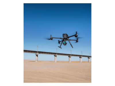
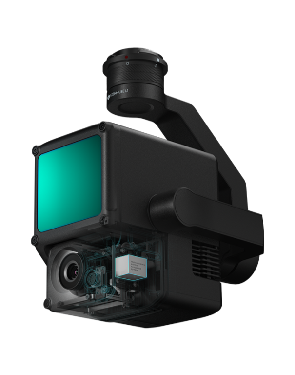
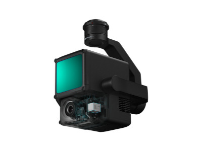
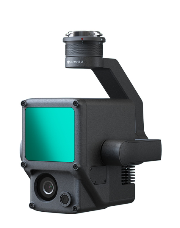
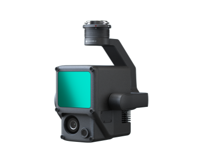
DJI Zenmuse L1 LIDAR
 Delbetalning från 5273 sek/månad
- Stockholm (butik & online order): Ej på Lager
- Webblager (endast online order): 1

En Lidar + RGB-lösning för flygundersökning
Zenmuse L1 integrerar en Livox Lidar-modul, en IMU med hög noggrannhet och en kamera med en 1-tums CMOS på en 3-axlig stabiliserad kardan. När den används med Matrice 300 RTK och DJI Terra, bildar L1 en komplett lösning som ger dig 3D-data i realtid hela dagen, effektivt fångar detaljerna i komplexa strukturer och levererar mycket noggranna rekonstruerade modeller.
Förväntat leveransdatum sker i mars.
Kontakta oss på enterprise@djistockholm.se
Dela produkten
- Produktinformation
- VANLIGA FRÅGOR OCH SVAR
Produktinformation


Digitalisera utan kompromisser
Exceptionell effektivitet
Skapa punktmolnsmodeller i färg i realtid, eller skapa 2 km2 punktmolndata i en enda flygning med Livox Lidarmodul med en 70 ° FOV och en kamera för synligt ljus med en 1-tums sensor.
Alltid flygbar
IP44-klassificeringen gör att L1 kan köras i regniga eller dimmiga miljöer. Tack vare aktiv scanning med Lidar-modulen kan du flyga på natten.
Point Cloud LiveView
Punktmoln i realtid ger omedelbar insikt på plats, så operatörer informeras om att snabbt fatta kritiska beslut.
Du kan också verifiera kvaliteten på fältarbetet genom att kontrollera punktmolndata direkt efter varje flygning.
Mätning och markering
Skaffa och kommunicera kritiska dimensioner på punktmolnmodellen med hjälp av mätningar och anteckningar.
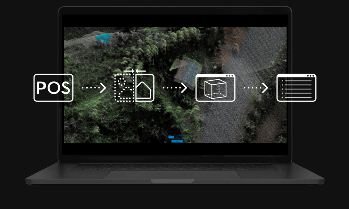
One-stop Post-processing
DJI Terra smälter samman IMU- och GNSS-data för beräkningar av punktmoln och synligt ljus, förutom att göra POS-dataräkningar så att du enkelt kan skapa rekonstruerade modeller och noggrannhetsrapporter.
VANLIGA FRÅGOR OCH SVAR
- General
-
The L1 has an IP44 rating according to the IEC60529 standard. This means that it is protected against solid objects over 1mm in size and against water splashed from all directions. The protection level is not permanent however and will decrease over time due to device wear.
To ensure the highest levels of protection:
• Before installing, make sure that the interface and surface of the gimbal are dry;
• Before use, make sure that the gimbal is firmly installed on the drone and the SD card protective cap is clean, free of foreign objects, and closed;
• Before opening the SD card protective cap, wipe the surface of the drone clean. -
The L1 is compatible with the M300 RTK. Before using, please upgrade the firmware of the drone and remote controller to the latest version.
-
The L1 currently supports only the Android version of the DJI Pilot App.
-
The camera requires a MicroSD card with Class 10 or higher transmission speed or rated UHS-1 , with up to 256 GB supported.
-
In Non-repetitive Scanning mode, the FOV is 70.4°x77.2°.
In Repetitive Scanning mode, the FOV is 70.4°x4.5°. -
The maximum measuring range of the L1 is 190m@10%, 100klx ; 450m@80%, 0klx.
The recommended typical working height is 50m-150m. -
The L1 provides three scanning frequencies: one/two returns: 80K/s, 160K/s, and 240K/s; three returns: 80K/s, 240K/s.
-
The L1 has two scanning modes: Non-repetitive Scanning mode and Repetitive Scanning mode.
-
The L1 supports 4 types of returns:
One return: highest intensity;
One return: first return;
Two returns;
Three returns.[TR2] -
The L1 collects point cloud models based on RTK and displays the collected models on Pilot in real time.
The following features are supported:
· Rotating, dragging, zooming, quick switching of perspectives, and centering;
· Multiple coloring modes including RGB, reflectivity, and elevation;
· Basic measurement functions including distance, angle, and plane area;
· Importing data into DJI Terra to display directly. -
For high-accuracy post-processed modeling, you can import the data from the SD card into DJI Terra with one click. This will generate a colorized point cloud model with high-accuracy PPK-IMU position and orientation calculation supported.
-
· The L1 supports the following model reconstruction formats:
· Point cloud formats: PNTS, LAS, PLY, PCD and S3MB;
· Model formats: B3DM, OSGB, PLY, OBJ and S3MB. -
The L1 currently supports Aerial photography and Corridor mapping flight.
-
The L1 supports ground-based stationary 360° model data collection*.
*Support coming soon. -
In typical operating scenarios, the IMU accuracy of the L1 is 0.025°(roll/pitch)/0.08°(yaw).
-
The vision sensor provides altitude data. This means that if the GNSS signal temporarily fails, the aircraft's accuracy will not be affected for up to 60 seconds.
-
The RGB camera of the L1 provides basic functions for taking photos and recording videos and provides real-time color information for the point cloud data during the scanning process. This allows the L1 to output true color point clouds and reality models.
Note that Lidar scanning and video recording cannot work simultaneously. -
During real-time point cloud in the Pilot, the point, line and plane measurements can be performed.
-
At a flight height of 50 m, the vertical accuracy of the L1 can reach 5 cm and the horizontal accuracy can reach 10 cm.
-
The Lidar module of the L1 has active detection capability which can scan terrain to collect point clouds during nighttime or other low light conditions.
-
The Lidar module of the L1 adopts an Advanced Frame Scanning mode. This ensures that all point clouds collected are valid point cloud data.
-
At a flight height of 100 m and a velocity of 10 m/s, a single flight with the M300 RTK and the L1 can collect data covering an area of 2 km2.
-
The L1 can be widely used in multiple scenarios including:
· Topographic surveying and mapping
· Power transmission line corridor modeling
· Emergency response surveying and mapping
· Detailed modeling
· Agriculture & forestry investigation -
The L1 can be mounted on the right downward gimbal port (when facing the drone) or the upward gimbal on top of the M300 RTK.